
View All North / North Central Idaho Adventures
Long Canyon & Parker Ridge
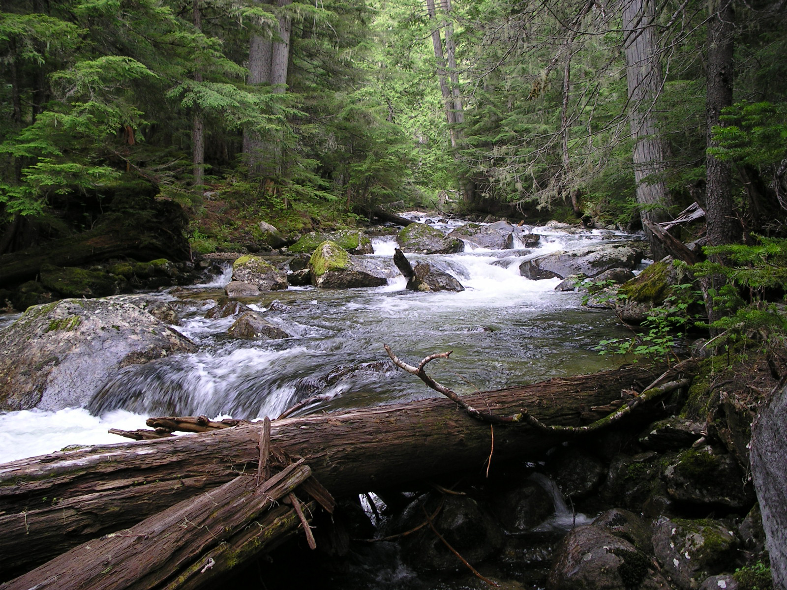
Local members of the Boundary Backpackers and the Idaho Conservation League have worked tirelessly for years to protect Long Canyon and Parker Creek. We have a large scrapbook in our office, recounting the history of how local citizens protected the last two unlogged drainages in the American Selkirks.
Thanks to these efforts, you can still see giant old-growth cedars in Long Canyon. Trail 16 runs nearly three-quarters of the length of the canyon (13 miles) in virgin forests.
If you’re an ambitious backpacker, you can continue on, climbing up out of the canyon on Trail 7 to Parker Ridge Trail 221. You’ll find great camps at Long Mountain Lake, Parker Lake and in a cirque basin on the southeast side of Parker Peak.
The walk through the canyon is markedly different than along the ridge, offering the full spectrum of habitat types, trees and wildlife found in the Selkirks. Although the elevation gain and total miles are daunting on paper, completing the entire “loop” is a one-of-a-kind experience.
Directions:
About 15 miles north of Bonners Ferry on Highway 1, turn left at the Copeland Junction. Drive 10 miles-crossing the Kootenai River and bearing right at the junction with the West Side Road-to the trailhead for Long Canyon Creek Trail 16. If you decide to do the loop to Parker Ridge, leave a shuttle car or bike 3 miles back at the trailhead for Parker Creek Trail 221.
Location: Selkirk Mountains
Status: Proposed Wilderness
Maps: ICL Guide to the Selkirks; Kaniksu National Forest; or Google Maps
Location
Selkirk Mountains
Distance
26 to 35 miles round trip
Elevation
2,550 to 5,820 ft
Difficulty
Strenuous
Maps
USGS Smith Peak, Pyramid Peak, Shorty Peak and Smith Falls
Status
Proposed Wilderness
More Info
100 Hikes in the Inland Northwest
http://www.sandpointonline.com/catalog/product_info.php?cPath=21&products_id=35&osCsid=cc5c8651fd6099d42b5502c1f9b5e612