
View All Central / East Idaho Adventures
Chamberlain Basin
Not for the faint of heart, this hike will get you to some terrific views of the White Clouds and Castle Peak. Follow the trail along Germania Creek, cross Washington Creek and turn left at the next junction. You will climb for a mile and hit another junction – stay right. If you cross Washington Lake Creek (different from Washington Creek) you have missed the turn off. Switchback through trees, cross some meadows and continue to climb to the top of a 9,800 ft saddle. Phew.
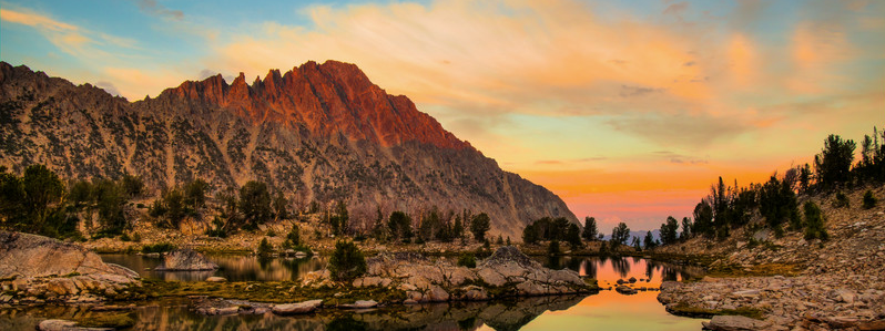
Enjoy the spectacular view of the basin below, Castle Peak, and the White Clouds.
Descending to Chamberlain Basin, you will pass a barren first lake. Continue a mile and a quarter to the junction for Baker and Boulder Chain Lakes. Turn left here by the outlet stream of the second lake. To reach the more beautiful upper lakes, follow the trail around the north shore of the second lake for a quarter mile, then hoof it cross-country for a mile. Head west then north to reach the southern end of the large upper lake. This hoofing will take a while. Plan accordingly.
Directions:
Drive north from Ketchum on Highway 75 for 36 miles to Pole Creek Road, just before Smiley Creek Lodge. Turn right onto the gravel road and stay right at the first fork (Valley Road) – about 2.5 miles from the highway. Drive on Pole Creek Road for about 13 miles, crossing Pole Creek Summit. Ford Germania Creek, drive a short distance and turn left onto a grassy parking area.
We advise a high-clearance vehicle.
Location: White Clouds Wilderness
Status: Designated wilderness
Maps: Sawtooth National Forest, SNRA, Ketchum & Fairfield Districts; or Google Maps
Location
Boulder-White Clouds
Distance
16 miles round trip to upper lakes
Elevation
3,000 ft
Difficulty
Difficult
Maps
USGS Boulder Chain Lakes; Horton Pk.; Washington Pk.; or Galena Pk.
Status
Designated Wilderness
More Info
Day Hiking Near Sun Valley